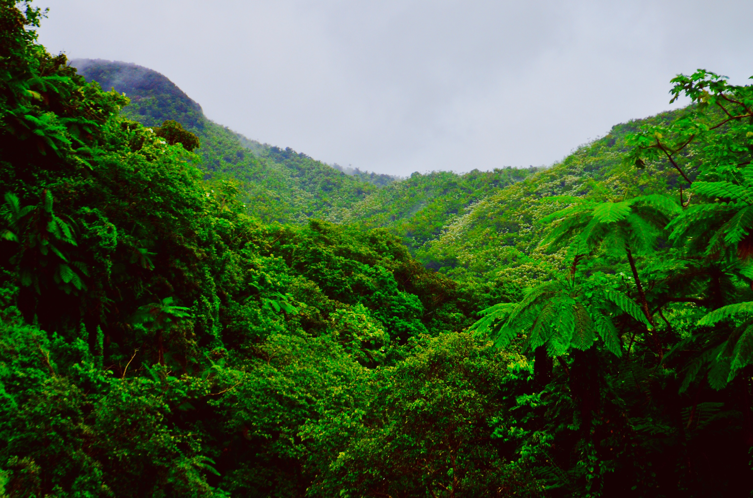
 An international team of scientists and archaeologists using Light Detection and Ranging (LiDAR) technology to survey areas of the Guatemalan jungle have discovered that the Maya civilization was much larger than previously thought. LiDAR uses a laser to measure distances to the Earth’s surface and is applicable to many other areas of research, including self-driving cars.
These titles explore LiDAR and its various applications.
Light Detection and Ranging (LIDAR) Deployment for Airport Obstruction Surveys
TRB’s Airport Cooperative Research Program (ACRP) Research Results Digest 10: Light Detection and Ranging (LIDAR) Deployment for Airport Obstruction Surveys explores the readiness of LIDAR technology as a cost-effective alternative to the traditional methods for collecting the data required to …
TRB’s National Cooperative Highway Research Program (NCHRP) Synthesis 446: Use of Advanced Geospatial Data, Tools, Technologies, and Information in Department of Transportation Projects that explores the development, documentation, and introduction of advanced geospatial technologies within …
Permafrost is a thermal condition — its formation, persistence and disappearance are highly dependent on climate. General circulation models predict that, for a doubling of atmospheric concentrations of carbon dioxide, mean annual air temperatures may rise up to several degrees over much of the …
Laser Radar: Progress and Opportunities in Active Electro-Optical Sensing
In today’s world, the range of technologies with the potential to threaten the security of U.S. military forces is extremely broad. These include developments in explosive materials, sensors, control systems, robotics, satellite systems, and computing power, to name just a few. Such technologies …
Satellite Observations to Benefit Science and Society: Recommended Missions for the Next Decade
Satellite Observations to Benefit Science and Society: Recommended Missions for the Next Decade brings the next ten years into focus for the Earth and environmental science community with a prioritized agenda of space programs, missions, and supporting activities that will best serve …
Elevation Data for Floodplain Mapping
Floodplain maps serve as the basis for determining whether homes or buildings require flood insurance under the National Flood Insurance Program run by the Federal Emergency Management Agency (FEMA). Approximately $650 billion in insured assets are now covered under the program. FEMA is …